

The Local newsletter is your free, daily guide to life in Colorado. For locals, by locals.
- Length:
- 5.4 miles (round-trip)
- Difficulty:
- Moderate
- Trailhead:
- Herman Gulch (39.70271358846311, -105.8542724711646)
- Why we love it:
- It’s a less-trafficked hike, right next door to Herman Gulch Trail
- When to go:
- Early June through late September
- Restrooms:
- Outhouse at the trailhead
- Dogs:
- Allowed on leash
It’s no secret Herman Gulch Trail is one of the most popular hikes near Denver. While the 6-mile trek features everything we love about Colorado—wildflowers, mountain views, and an alpine lake—the trail is often crowded, especially in the summer months, making it less of the serene escape that many adventurers are looking for when they head for the hills.
But hikers who are dismayed by the masses traversing Herman Gulch have another, less-congested option: At the same trailhead is Watrous Gulch Trail, an equally challenging and beautiful hike that winds through Arapaho National Forest and ends with sweeping views of the Continental Divide.

From the trailhead, veer right for Watrous Gulch, which starts at a moderately steep and rocky incline. You might still hear cars passing on I-70 as you ascend, as the trail is located right off the highway. But after about a half mile, the path starts to meander through an aspen grove, which blocks out the noise from the road and offers a brief escape from direct sun exposure.

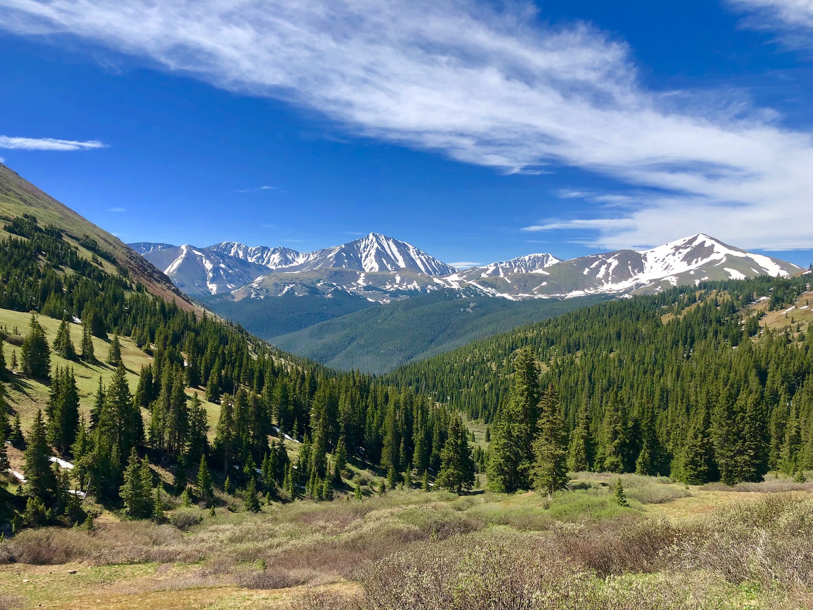
Once through the aspen grove, the trail opens up to views of snow-capped peaks. From here, you can expect to see wildflower blooms for the next two miles (especially in late July and early August during wildflower season). About a mile-and-a-half in, a bustling stream appears alongside the trail and follows for the remainder of the hike, providing a relaxing soundtrack of rippling water to accompany the views.

At the second mile, the trail crosses the stream and moves into a meadow. From there, you’ll wander in-and-out of tree coverage (so don’t forget your sunscreen). Before long, the trail comes to a saddle and the path grows more strenuous as you reach the hike’s highest elevation: 12,516 feet. During this section, the trail becomes less obvious, so look out for the cairns that mark the correct route.
Whether or not you finish on the right path, you are guaranteed to feel accomplished by the unobstructed, 360-degree views ahead. Pick a spot to rest and refuel (you’ve earned it!), before retracing your steps to your car—and the crowds.
Getting There: Take I-70 west to exit 218. Turn right turn onto Watrous Way. There’s a dirt parking lot at the base of the trail.


