

The Local newsletter is your free, daily guide to life in Colorado. For locals, by locals.
In true Colorado fashion, snow has been the talk of the town this week. That’s because the biggest snowstorm of the year is headed this way. Some predictions have even suggested it has the potential to be one of the largest snowstorms in the history of the Denver area.
Early in the week, we saw some wild forecasts, showing that the Front Range could get as much as five feet of snow. While that appears unlikely, some big totals are possible. One foot of snow is probably in the cards. Three feet of snow is a lot less likely, but it could happen.

To help you prepare, we broke down everything you need to know about the coming storm.
What Is Causing This Weird Weather?
The storm that we are tracking was swirling near San Francisco, bringing rain, flooding, mudslides, hail, and thunderstorms. That’s notable because it speaks to the amount of energy the storm already holds. According to long-range weather models, the storm should head on to Las Vegas by Friday, before moving toward Colorado over the weekend.
History has told us that a low-pressure system during this time of year is always something to watch. During March, which is typically Denver’s snowiest month, we get warmer air (which holds more water), and clashing temperatures (which make storms stronger), both of which help produce lots of snow.
Five to six days out from the likely arrival of the storm, weather models were predicting wild 50- to 70-inch totals for the Denver area and surrounding foothills. Now that we are closer to the start of the event in Colorado, those models have gone down slightly, but not by as much as you’d expect.
For Denver and the surrounding areas to get absolutely blasted with snow, the center of the low-pressure system will have to track over southeast Colorado. In that case, winds around Denver will blow out of the east and northeast, which forces air up the Rocky Mountains to our west and the Palmer Ridge to our south. When you have rising air, you get moisture. Locations like Evergreen, Estes Park, Boulder, Castle Rock, Idaho Springs, and Monument would likely be hardest hit in such a scenario. Usually, the duration of these winds and the amount of available moisture are what determine snow totals during these events.
Long-range, trusted weather models have predicted the center of the strong, low-pressure system will travel over southeast Colorado. Those same models have also noticed that this particular storm is slow moving and almost stationary at times. It is even grabbing more moisture from the Gulf of Mexico and swinging it up toward us. The combination of a slow-moving storm with upslope winds will contribute to high snow totals.
An added perk to mention is that storm could deliver upwards of two inches of liquid in some areas. The last time Denver got more than one inch of liquid in the rain gauge was back in July of 2019. This moisture should help tremendously with the ongoing drought across the region.
OK. So, How Much Snow?
Forecast totals can and will change between now and the weekend. As it currently stands, it is possible that we will experience one of the top snowstorms in Denver’s history, and one of Denver’s largest March snowstorms on record as well.
Will we be breaking snow records this weekend in Denver?
It's looking possible!
Here are the top 5 snowstorms on record for Denver and the top 5 bigger March snowstorms that occurred in Denver. #COwx #Colorado #Weather #Denver #FrontRange pic.twitter.com/6EIaYbaM4Q
— ⛈Rain or☀️Shine I’m Andy Stein (@AndySteinWx) March 10, 2021
We need 16.9 inches to make it on the list of biggest March storms and we need 23 inches to make it on the list of biggest snowstorms ever. Here are the expected totals as of Thursday morning:
12-20" coming to Denver!
Upwards of 3 FEET in other areas. #WinterStorm #COwx #Denver #Colorado pic.twitter.com/QDUSBvrcGa— ⛈Rain or☀️Shine I’m Andy Stein (@AndySteinWx) March 10, 2021
- Fort. Collins: 24–30 inches
- Estes Park: 24–30 inches
- Rocky Mountain National Park: 24–36 inches
- Boulder: 24–30 inches
- Downtown Denver: 18–24 inches
- Evergreen: 24–30 inches
- Castle Rock: 18–24 inches
- Colorado Springs: 4–14 inches
What is impressive here is the amount of snow on the low-end of the chart. It takes just six inches of snow in 12 hours for Denver to be under a Winter Storm Warning. Most areas will definitely get more than that. Roads will be difficult to drive on, if not impossible to traverse. This is going to be a big Colorado snowstorm and it’s going to last a couple of days.
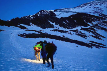
For the mountains, this is a much simpler forecast. Most of the high country, excluding the Wet Mountains in southern Colorado, will see at least a foot of snow through the weekend. It’s already started snowing there and it will continue, making travel difficult for the next five days.
There are several factors, though, that should be watched between now and this weekend. The possibility of this storm tracking further north than currently forecasted is possible. That could really limit snow totals across the area. We also have to watch the speed of the storm. If it moves faster, then we will see less snow. Another aspect to pay attention to is how much warm air will be around. Temperatures will hover near freezing Saturday and Sunday afternoon and if too much warm air moves in, we could initially have more rain than snow. Finally, other severe storms created by the same system could use up too much energy, reducing the amount of flakes Colorado receives. These are all possibilities, which is why this storm is such a struggle to forecast.
The snow is supposed to begin Friday night and continue through Monday morning, so this is a full-on weekend event. Again, travel is not advised this weekend. If you can avoid it, please do.
Sunday may be the worst day of the weekend because it is expected to be very windy. There could be blizzard conditions at times in and around Denver. Overall, this is a developing storm and the details will continue to change. But we should all definitely be prepared for a whole lot of snow.