


The Local newsletter is your free, daily guide to life in Colorado. For locals, by locals.
Length: 3 miles round-trip
Difficulty: Easy
Why We Love it: This beautiful, high-elevation outing offers an opportunity to explore a stretch of the historic Continental Divide Trail without the commitment of an overnight backpacking trip.
When to go: Late May through early October, when the access road is clear of snow
Pre-hike buzz: Visit the cozy Steamboat Coffee House for breakfast burritos, frittatas, and hand-pulled lattes and iced cappuccinos made with Telluride-based Steaming Bean coffee blends.
Dogs: Allowed on leash
This fall marks the 40th anniversary of the establishment of the spectacular Continental Divide National Scenic Trail, one of our nation’s greatest long-distance hiking routes and largest conservation projects. Its 3,100 miles follow the Rocky Mountains’ lofty spine across five states, from the Canadian to the Mexican border. Colorado’s 650-mile portion features the highest, most rugged, and most remote terrain—as well as some of its most stunning scenery.

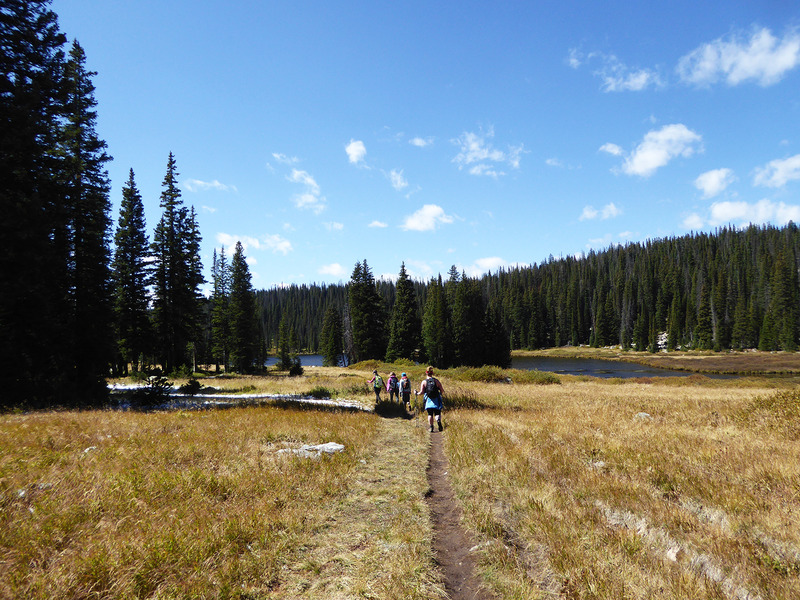
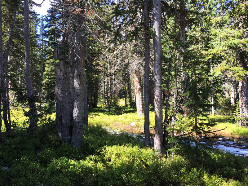
For those of us who lack the six or seven months of vacation time necessary to hike the entire route, which is currently about 70 percent complete, one of Colorado’s most easily accessible sections begins atop Rabbit Ears Pass southeast of Steamboat Springs. From the Base Camp Trailhead at just over 10,000 feet elevation, the CDT—which in this area is labeled as the Wyoming Trail (#1101)—descends about 800 feet through towering spruce-fir forest to a grassy alpine meadow. This stretch of the trail dates to the early 1900s, when ranchers used it to drive their sheep between large ranches in northwestern Colorado and southern Wyoming.
In just over a mile, the trail reaches the shores of beautiful Fishhook Lake, whose dark blue waters are teeming with trout. From here, it’s another 0.2 miles to a short spur that leads to Lost Lake, where you can sit on large logs tucked beneath the trees and linger over a picnic lunch.
From Lost Lake, you can either retrace your steps to your vehicle or, time and weather permitting, continue north along the trail for an additional two to three hours to sample four more of the CDT’s surreal lakes, including Lake Elmo and Little Lost Lake. Whatever you decide, you’ll return to civilization knowing that you’ve walked a path deeply rooted in Colorado conservation history.
Getting there: From Steamboat Springs, drive east on U.S. 40 for 19 miles to the sign for Dumont Lake. Turn left (north) at the sign and follow Forest Road 315 about 1.5 miles to the junction with Forest Road 311, which is located near an old stone monument. Turn left onto FR 311 and proceed 4.5 miles along a very rough and often muddy road to the Base Camp Trailhead.
Logistics: This trailhead is not always accessible by AWD vehicles, especially if it has recently rained or snowed. If your vehicle isn’t up for the challenge, you can walk or cycle into the trailhead or rent a jeep for half a day from locally owned Steamboat Jeep Rentals.


